
WHERE DOES WATER FOR THE ENVIRONMENT GO AND why?
How water for the environment is helping plants and animals in northern Victoria.
Many of Victoria’s rivers and wetlands have been modified to provide water vital for farms, homes and industry. Water for the environment is used to improve the health of rivers and wetlands and support the plants, fish and other animals that live, feed and breed in them.
Water for the environment also benefits communities by improving conditions for fishing, camping and canoeing. Improved water quality can have economic benefits for irrigation and urban water supply.
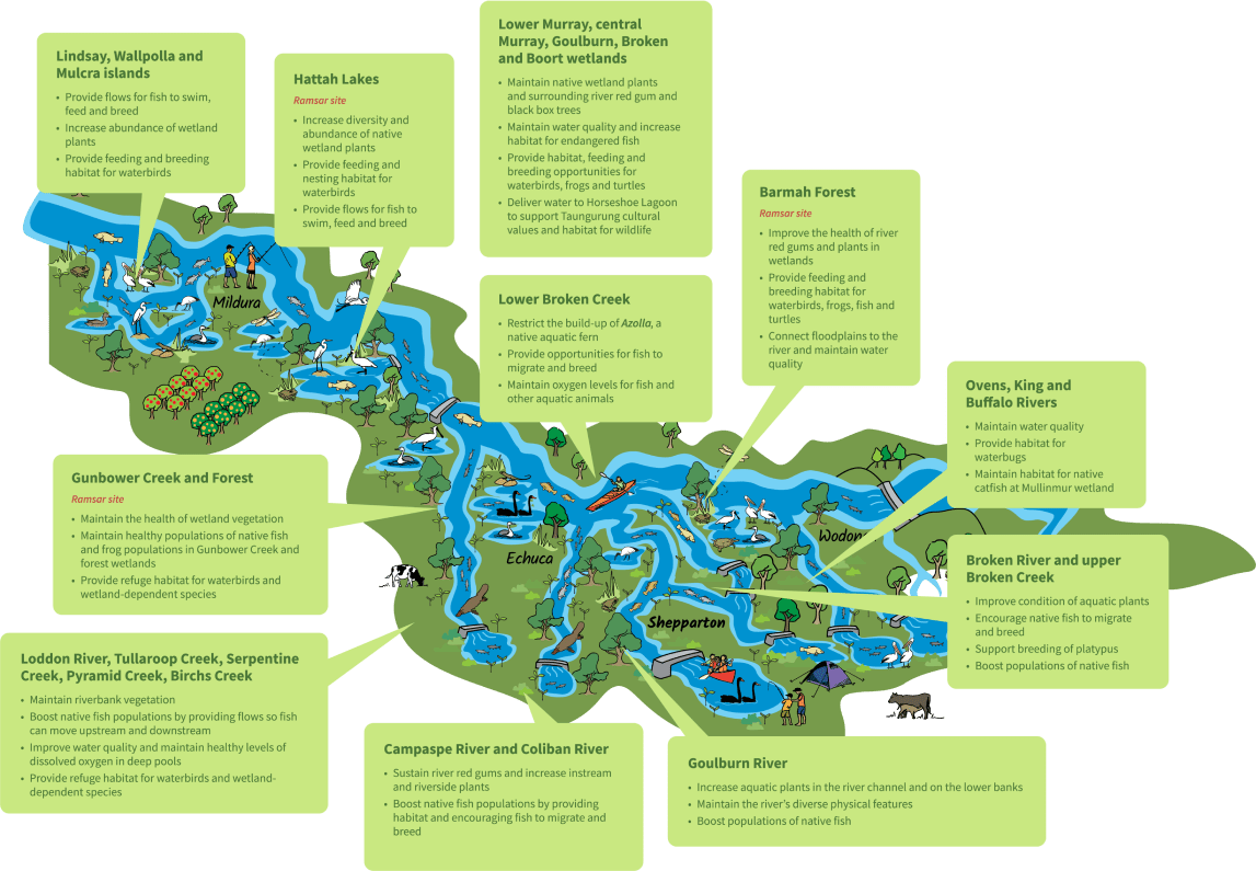
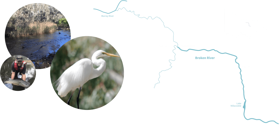
This map shows some examples of where and why environmental water is used in northern Victoria.

ACKNOWLEDGEMENT OF COUNTRY
We acknowledge and respect Traditional Owners and Aboriginal communities and organisations. Some of the species that benefit from water for the environment:
We recognise the diversity of their cultures and the deep connections they have with Victoria’s lands and waters.
We value partnerships with them for the health of people and country. We pay our respects to Elders past and present, and acknowledge and recognise the primacy of Traditional Owners’ obligations, rights and responsibilities to use and care for their traditional lands and waters.
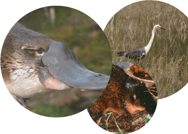
Some of the species that benefit from water for the environment:
River red gum – Balboort
Eucalyptus camaldulensis
Slender knotweed
Persicaria decipiens
White-necked heron
Ardea pacifica
Rakali
Hydromys chrysogaster
River blackfish
Gadopsis marmoratus
Black box – Daagiin
Eucalyptus largiflorens
River swamp wallaby grass
Amphibromus fluitans
Australian white ibis
Australian white ibis
Murray cod
Maccullochella peelii
Trout cod
Maccullochella macquariensis
Giant rush
Juncus ingens
Yellow-billed spoonbill
Platalea flavipes
Azure kingfisher
Ceyx azureus
Golden perch
Macquaria ambigua
Freshwater catfish
Tandanus tandanus
Water ribbons
Triglochin procerum
White-faced heron
Egretta novaehollandiae
Little pied cormorant
Microcarbo melanoleucos
Silver perch
Bidyanus bidyanus
Platypus
Ornithorhynchus anatinus
THE LIVING MURRAY (TLM) ICON SITES
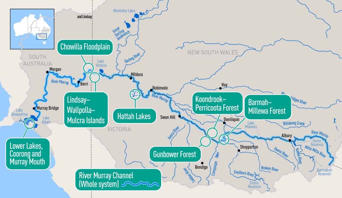
Location
The Living Murray is one of Australia’s largest river restoration programs. It began in 2002 following a long-term decline in the health of the Murray River from over extraction of water, regulation from dams and weirs, and a changing
Values
The icon sites were chosen for their high cultural, ecological and economic value. All icon sites are nationally important and most, such as Barmah, are listed as internationally significant wetlands. The Barmah-Millewa Forest is the largest river red gum forest in Australia and when flooded, provides habitat for thousands of waterbirds. The forest is a place of major cultural and spiritual significance to the Traditional Owners, the Yorta Yorta people.
Water for the environment
Water for the environment is delivered and managed at the six icon sites, in some cases through infrastructure such as pumps and regulators. The watered area covers morethan 37,000 hectares of forests, wetlands and lakes along the Murray River, which benefits multiple plants, animals and communities.
Watering may include flooding large areas of the river red gum forests or delivering smaller amounts to individual wetlands so native plants grow, and food, shelter and nesting areas are available for frogs, turtles, fish and waterbirds.
Delivery of water for the environment to the icon sites has resulted in improved growth and health of the river red gum forests, an increase in the diversity of wetland plants and breeding of native fish, frogs and waterbirds, some of which are rare or threatened.
The Living Murray is a joint initiative of the Australian Government and the governments of New South Wales, Victoria, South Australia and the Australian Capital Territory.
VICTORIAN MURRAY FLOODPLAIN RESTORATION PROJECT

Location
The Victorian Murray Floodplain Restoration Project (VMFRP) includes nine infrastructure projects (refer map) that aim to return a more natural flooding pattern to approximately 14,000 ha of high-value Murray River floodplain in Victoria. The project is at the design stage. If funding is approved under the Murray-Darling Basin Plan, the works will be operational by June 2024
Values
The nine sites were chosen for their environmental, social and cultural values. They include floodplain creeks, wetlands and some of the few remaining river red gum floodplain systems, that are not already targeted through The Living Murray program. These areas provide refuge and are hotspots for native plants and animals. They support many rare and threatened species and are important feeding and breeding areas for fish, frogs and waterbirds. The abundance of resources and the riverine environment are places of great significance to Traditional Owners, with many sites of major cultural and spiritual significance occurring across these landscapes.
Water for the environment
Under natural conditions, the Murray River would have regularly flooded these large floodplain areas. Extraction of water, regulation by dams and weirs, and a changing climate, means these areas no longer receive adequate flooding and have declined in health.
The works will allow water for the environment to be diverted from the Murray River to these areas. The watering will achieve similar environmental benefits to a natural flood (such as improved vegetation health and habitat for native fish, birds, frogs and turtles) but use much less water. This means less water needs to be recovered from irrigation communities under the MurrayDarling Basin Plan
The VMFRP forms part of Victoria’s obligations under the MurrayDarling Basin Plan. It is being delivered in partnership with Lower Murray Water, Goulburn Murray Water, Mallee CMA, North Central CMA, Parks Victoria and the Victorian Department of Environment, Land, Water and Planning (DELWP). The VMFRP is funded by te Australian Government’s Department of Agriculture, Water and Environment
BROKEN RIVER
Location
The Broken River begins in the Wellington-Tolmie highlands of central Victoria and flows west to Lake Nillahcootie. The river then flows about 120km through Benalla, entering the Goulburn River near Shepparton (refer map).
Values
The Broken River provides good quality habitat for native animals. The river supports many different native fish including the nationally threatened Murray cod, Macquarie perch, golden perch, silver perch and river blackfish. It is also home to a large population of platypus.
The Broken River, and its floodplain and wetlands, contain important Aboriginal cultural heritage sites and support a variety of recreational activities such as fishing, boating, birdwatching and bushwalking.
Water for the environment
Lake Nillahcootie was constructed on the Broken River in 1967. The lake fills over winter in most years, with water released over spring, summer and autumn to meet downstream demands such as irrigation. Lake Nillahcootie has changed the natural flow pattern in the Broken River by making winter-spring flows lower (as water is held back in the lake) and summer-autumn flows higher (as water is released to meet downstream water needs).
Water for the environment can be released from Lake Nillahcootie to help return more natural flows to the Broken River to keep it healthy. These flows include minimum base flows year-round to maintain habitat for native fish, waterbugs and plants. In summer or autumn, flows can be increased for up to a week (called a fresh) to increase the amount of instream habitat available, and encourage:
- Nutrient and carbon cycling which stimulates the river’s
food chain. - Movement of sediment to maintain deep pools.
- Upstream movement of native fish to breeding sites.
GOULBURN RIVER

Location
The Goulburn River is the longest river in Victoria flowing for 570 km from its
headwaters in the Great Dividing Range to the Murray River east of Echuca. Flows in the upper Goulburn River are captured in Lake Eildon, which is almost seven times the size of Sydney Harbour (refer map). Lake Eildon stores rain and runoff to support communities, irrigated agriculture and the environment at various locations downstream.
Values
In Taungurung language, the name for the Goulburn River in this region (midGoulburn) is Waring. The lower section of the Goulburn River, on Yorta Yorta country, is known as Kaiela in Yorta Yorta language. As well as providing abundant resources for Traditional Owners, there are many sites of Aboriginal cultural significance along the entire length of the Goulburn River.
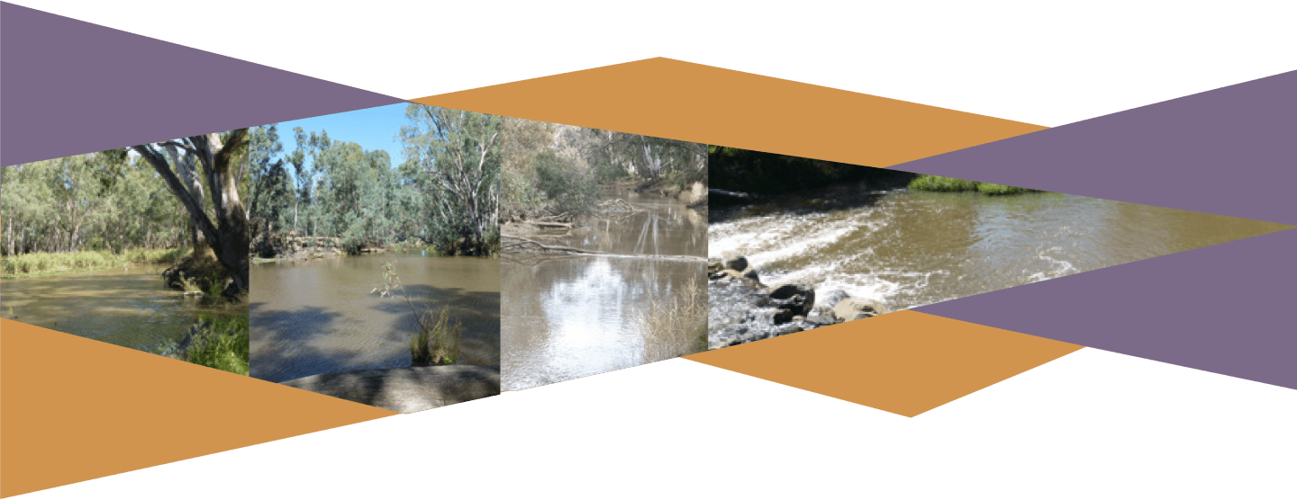
The Goulburn River is home to important native fish populations including threatened Murray cod, golden perch, silver perch, trout cod and freshwater catfish, along with turtles and platypus. The Goulburn River is Victoria’s most popular inland fishing destination and attracts large numbers of visitors.
Water for the environment
Natural flows in the Goulburn River have been altered by the construction of Lake Eildon and the Goulburn Weir (near Nagambie). At Goulburn Weir some of the river’s flows are diverted into the irrigation network across northern Victoria to meet irrigation and consumptive water needs. The changes to flow downstream of Lake Eildon mean the river generally runs high in summer and low in winter – the opposite of what would naturally occur. This impacts the health of the river, particularly native fish numbers.
Water for the environment is generally delivered along the Goulburn River in late autumn/early winter and again in spring. The autumn/winter flows aim to spread seeds on the banks and improve bank vegetation, water quality and habitat for waterbugs and native fish. Water delivered in spring helps seeds and plants establish and grow and can trigger golden and silver perch spawning.
Some of this good work has recently been compromised by record high transfers of water from the Goulburn River to the Murray River in summer to meet downstream demand. Consistently high summer flows “drown” the plants on the banks and make the banks more vulnerable to erosion. A more sustainable way of operating the river is being investigated. Maintaining deliveries of water for the environment in winter and spring each year is important to help the banks and vegetation recover
The long-term benefits of water for environment deliveries in the lower Goulburn River are being monitored through the Commonwealth Environmental Water Office’s Flow-Monitoring Evaluation Research (FLOW-MER) program.
HORSESHOE LAGOON

Location
Horseshoe Lagoon is located between Kerrisdale and Trawool, approximately 15km south-east of Seymour. The 20ha lagoon lies largely within the Horseshoe Lagoon Flora and Fauna Reserve, managed by Parks Victoria.
Values
Horseshoe Lagoon is a site of high cultural ignificance to Taungurung people. The wetland is also important to many local landholders who value the cultural, aesthetic, recreational and environmental values it provides. The reserve is close to the Great Victorian Rail Trail and there is a small walk-in camping area nearby.
Water for the environment
Historically Horseshoe Lagoon would have had some water in it most years. However, due to river regulation from Lake Eildon and climate change, the wetland is now only inundated after large floods. The lack of regular inundation has contributed to a decline in the health of the wetland. Water for the environment was delivered to the wetland for the first time in 2019, in partnership with Taungurung, by pumping water from the Goulburn River. To celebrate, Taungurung women sang and danced to acknowledge their cultural connections and for the revival of the wetland. The environmental response was almost instant: wetland plants (many considered threatened or vulnerable) including giant rush, water ribbons, water pepper, knot weed and river swamp walla by grass grew and flowered. Good numbers of birds including yellow-billed spoonbills, white-necked herons, Australian white ibis, azure kingfishers and little pied cormorants were also recorded along with turtles, rakali, wallabies, echidnas and kangaroos.
